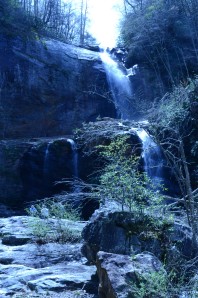
It’s a beautiful April morning, and I’m hiking into an area below Glenville dam to see a waterfall on the West Fork of the Tuckasegee River that not many people take the time to see.
The path – an old road – is lined with wildflowers: bluets, violets, white violets, star chickweed, squirrell corn and hundreds of trillium, white and purple, that carpet the floor of the woods along the trail.
The waterfall I’m visiting is called Tuckaseigee Falls in one instance and High Falls in another. The first reference is in a caption to a picture (above) of the falls in the book, Occoneechee, The Maid of the Mystic Lake , by Frank Jarrett, founder of the Jarrett House in Dillsboro.
The caption for the Tuckaseigee Falls picture locates it as “above Dillsboro, N.C.”
Well, it is indeed above Dillsboro but by quite a few miles.
Jarrett’s book was first published in 1916, and the photograph shows the waterfall at full flow, which is how it looked until the Glenville dam was built in 1941.
The second reference, High Falls, was contained in a book, The Scenic Resources of the Tennessee Valley. It called the falls one of the three or four most impressive cataracts in the Tennessee Valley. But it was published in 1938, also before the construction of the dam.
Regardless of what it’s called, the falls — even with a reduced flow – is worth the hike, which is about 4.5 miles round trip. Before you get to your goal, you are treated to another spectacular falls, Rough Run. There is no dam blocking this water as it falls a hundred feet, at least, into the Tuckasegee River.
Finally at the Tuckaseigee Falls, I start shooting photos so that I can compare them to the shot in Jarrett’s book. The shape of the falls is readily recognizeable from the old photo, even though the flow seems only about a third of its original.
I run into a group of Cashiers area folks who have been on a wildflower hike and are eating lunch at the falls. Their leader, Carl Blozan, tells me he has seen the falls at full flow when he and his wife Kathie hiked in shortly after Hurricane Ivan hit in September, 2005.
The rocks below the falls are a great place to eat lunch. It’s a fairly safe area, except for some slick rocks. So watch your footing. It’s an especially bad idea to climb the heights to get a better view of the falls.
My duties finished, I take leave of the other hikers and walk the two-plus miles back to my truck.
This is a fairly easy hike, not-so-strenuous ups and downs. To find the trail head, go south on NC 107 from the Sylva-Cullowhee area. Just before you reach Glenville, take the Shoal Creek Road to the right . Park when you see a gated road to the right. Then start hiking the gated road. Early on, there is one fork, take the left one which goes uphill, the other goes down.
The road will turn in to more of a path, but is easy to follow. After you’ve admired Rough Run, the path to the falls is easy to follow. To get below the falls, you will have do some scrambling over rocks. But it’s not hard.
— Bill Lee


